
Weather update: Wednesday December 17th 5am

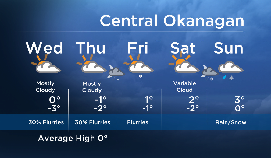
Today will be similar to yesterday. The risk of a few snowflakes continues under a weak southwesterly flow aloft, but little accumulation is expected, if any.
Tomorrow will also be comparable, but the risk of flurries will increase Thursday night and Friday as a stronger disturbances moves inland Friday.
The email you need for the day's
top news stories from Canada and around the world.
On Saturday, we will be in between systems and sunny breaks are possible, but another moderate weather system will move in on Sunday. However Sunday’s system will also bring milder air and raise freezing levels. This means we will likely see a mix of rain and snow for the second half of the weekend.


See you at 5, 6:30 and 11pm tonight!
Today’s Highs: -4 to +2C
~Wesla/Duane
More on Canada
- Roll Up To Win? Tim Hortons says $55K boat win email was ‘human error’
- Ontario premier calls cost of gas ‘absolutely disgusting,’ raises price-gouging concerns
- Bird flu risk to humans an ‘enormous concern,’ WHO says. Here’s what to know
- Election interference worse than government admits, rights coalition says
Comments