
Good morning ! Hope you had a great weekend.

No surprise here… another day starting with valley cloud. One of the reasons why this cloud is still around is because of the temperature inversion – at 5am this morning the weather balloon had these readings:
At 500m: -7C
At 1000m: -8C
At 1600m: -4C
At 2500m: 0C (so quite a bit warmer at this level!)
Hard to say if and when this valley cloud will dissipate today, but there is hope that at least some areas will see clearing midday and be in the sun this afternoon.
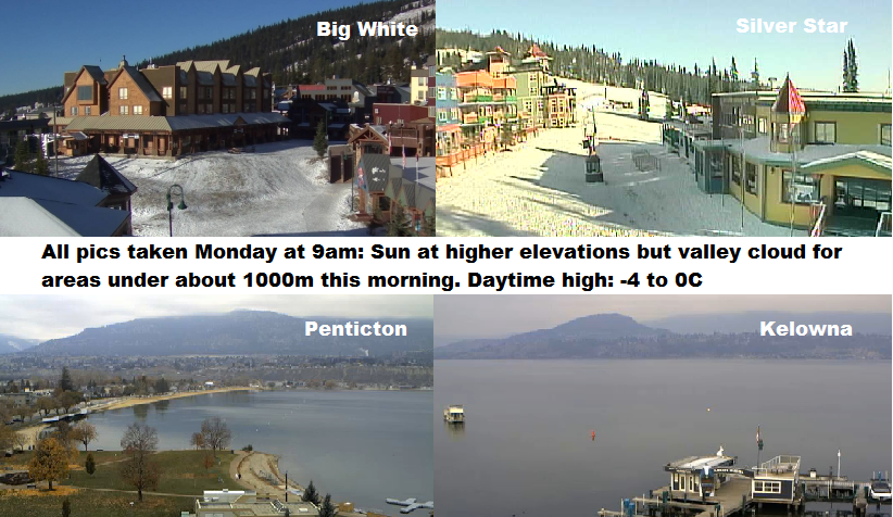
Today’s Highs: -4 to 0C
As for this week, the upper ridge will start to weaken midweek. This will break down the temperature inversion, however a westerly flow will also bring cloud to all elevations Wednesday. Although no significant snow is expected, a slight chance of flurries is in the forecast Wednesday and Thursday.


Looking ahead, a stronger system will try and push in late Friday.
All of your weather details are coming up tonight at 5, 6:30 and 11pm – hope you can join us!
~ Wesla Wong / Duane English
Comments