
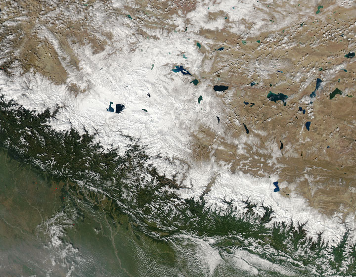
TORONTO – On Wednesday, NASA released satellite photos of the days before and the days after the deadly avalanche in Nepal that killed 38 people, including four Canadians.

READ MORE: Nepal promises to bring in new safety rules for trekkers after deaths
The images released by NASA’s Aqua satellite show the Himalayas on Oct. 11 and Oct. 16.

The storm responsible was Cyclone Hudhud, which had moved up southeastern India on Oct. 12. By Oct. 14, the large Category 4 storm with winds of 217 km/h and heavy rain affected many coastal towns.
Though Hudhud had weakened into a low pressure system, by the time it made landfall, it still dropped more than a metre of snow in the Himalayas.
October is typically the beginning of Nepal’s dry season, which is why many people choose to trek the mountain range.
Comments