
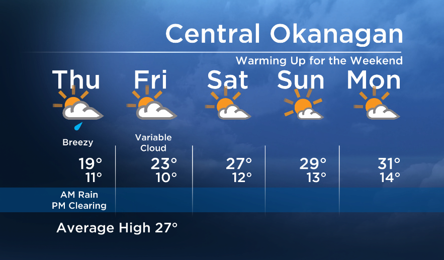
The upper low that was the culprit for Wednesday’s thunderstorms will continue to move east, bringing us a few more showers on Thursday before a much drier weather pattern in store for Friday and the weekend.

Because of the path of the low, the Okanagan will gradually clear first around Thursday midday, but it will take a bit longer the eastern/northern parts of our broadcast region – Arrow Lakes, Boundary, Columbia – to see any significant breaks.


A return to a westerly flow will dry almost all areas in the Southern Interior on Friday, and an upper ridge building in this weekend will warm us up again!
Thursday’s High: 16 to 24C
~Wesla/Duane
More on Canada
- Honda expected to announce Ontario EV battery plant, part of a $15B investment
- Trudeau says ‘good luck’ to Saskatchewan premier in carbon price spat
- Canadians more likely to eat food past best-before date. What are the risks?
- Hundreds mourn 16-year-old Halifax homicide victim: ‘The youth are feeling it’
Comments