
Weather update 4:15pm Monday June 23, 2014

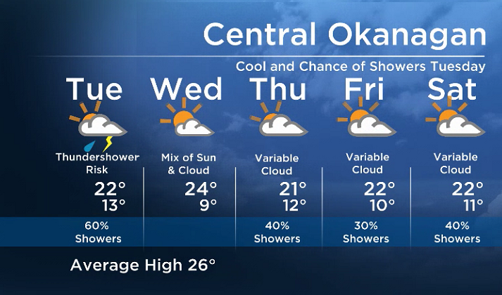
After a few days of warm weather, a weather pattern change is ahead as a cold front sweeps across BC Tuesday.
Tomorrow is a tricky weather day with breezy conditions at times.
There will likely be some partial clearing behind the cold front, but if and when we see that clearing, heating at the surface will trigger the development of possible isolated thunderstorms.
But don’t expect a lot of surface heating – daytime highs are expected to be at least several degrees cooler tomorrow.


With cooler air moving in aloft, even a moderate amount of heating at the surface might be enough for isolated storms to form.
Looking ahead, on Wednesday we will be in between systems and a drier day is expected before more unsettled weather on Thursday.
Tuesday’s High: 17 to 24C
~Wesla/Duane
- Budget 2024 failed to spark ‘political reboot’ for Liberals, polling suggests
- Train goes up in flames while rolling through London, Ont. Here’s what we know
- Peel police chief met Sri Lankan officer a court says ‘participated’ in torture
- Wrong remains sent to ‘exhausted’ Canadian family after death on Cuba vacation
Comments